Tuesday, October 13, 2015

Achievement Get: Boulder Day Hike Flatiron #1

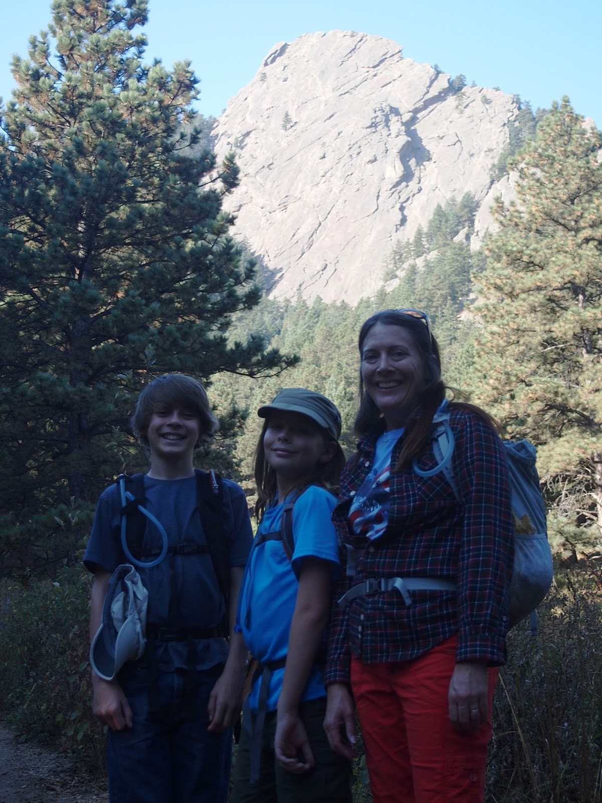
On the first day, we hiked to the first flatiron (Flatiron #1) from Chautauqua Park. This was only a 3 mile hike, but you gain over 1,400 feet in elevation and some of the climbing portions are fairly rocky and steep. However, practically the whole trail is beautiful. I would highly recommend this hike. Most trail guides you will read (such as ProTrails) give this hike a moderate / strenuous rating which I think is fair. But, if you take your time and aren't afraid of a little scrambling in a couple of rocky areas, this hike is easily worth the effort. What follows is a little beginning-to-end  photo journal with a few bonus shots at the end:
Flatirons from the trailhead
Our goal behind

Break looking at Flatiron #2

If you bring your ropes, you can climb the Flatiron faces

Pretty spectacular views of Boulder on the trail!


Flatiron #2 (looking South toward the Denver area)

The end of the trail on the back side of Flatiron #1!
Your reward for reaching the top is a fabulous view of the Continental Divide!
Flatiron #1 from the south side

Very dramatic! (with some visual effects)

Of course there were chipmunks - never take your eye off of them! They may be small, but they will tear your throat out in a second!

Wednesday, September 30, 2015

Colorado fun trip - Boulder, here we come!


We're going to try from the Gregory Canyon Trailhead to the summit of Green Mountain. Apparently the 360 degree view of the RMNP is amazing.

Sunday, June 10, 2012

Bright, Bright Angel, pt. 2

There has been a HUGE delay in creating this post.  However, as it is coming up on a year since we completed this journey, I've waxed nostalgic.  So here we are, the final installment of the Grand Canyon hike.  Certainly not our last hike though, and I hope not the last time we'll visit the Canyon. I've always had the backpacking bug, I think MG has learned to appreciate the possibilities of it, and soon our boys will be big enough to keep us hiking.

OK...back to the story and the truth about  Kaibab squirrels.  You don't really need to knife fight them, as I said before they are terrible at that - you'll win easily.  You see, the problem really is not that the Kaibab squirrel is all that cunning, it's that people are really stupid.  Over the years, the hordes of tourists have handed the squirrels tasty snacks and they continue to this day to fawn over the cute little things.  Only now, the squirrels have no fear of people.  They come right up to your pack and will gladly rummage through any open pouch and steal your food.
Dopes do this.

Squirrels learn to do this.


The moral is, and I can't stress this enough:  DO NOT FEED THE SQUIRRELS!


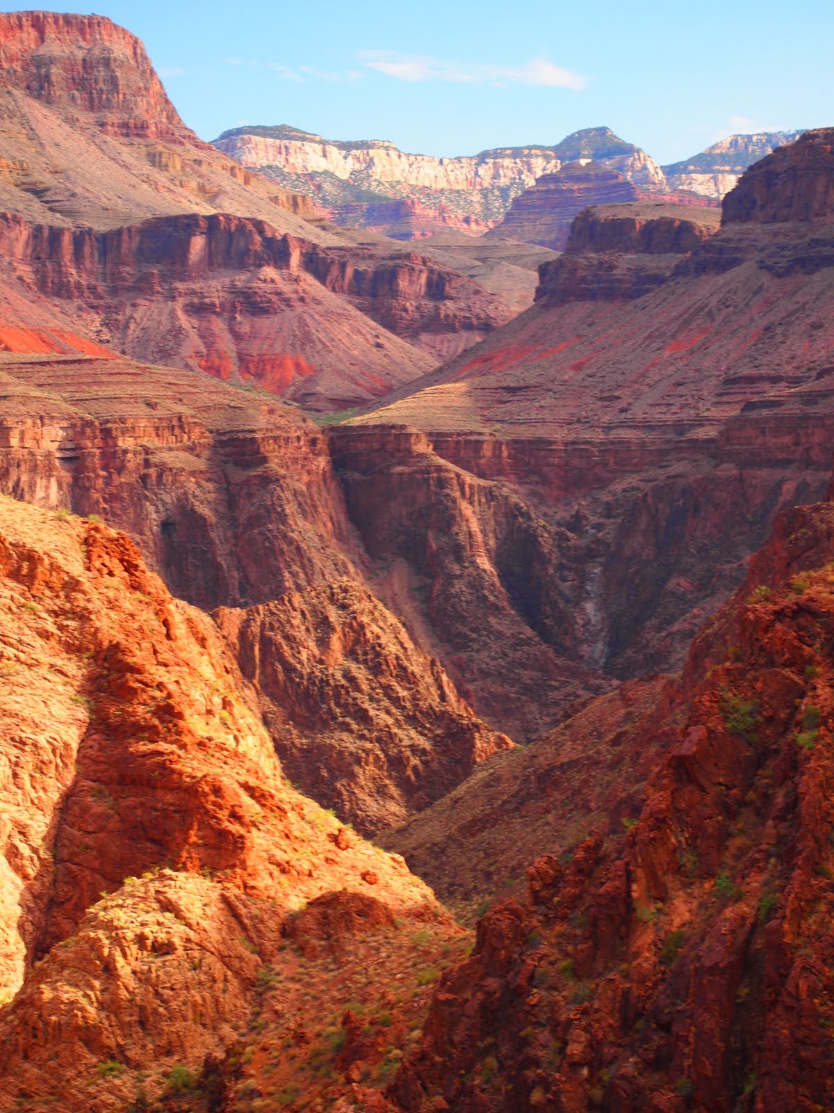
This is my favorite picture from the whole hike, taken from somewhere above Indian Garden...I think.

On with the trek and the return to the South Rim.  After leaving Indian Garden and a good rest, we started out for the second half of the journey.  And it was hot.  And you think the long trek through acacia, agave, yucca and assorted other canyon flora will go on forever.  And then, you see this:
Wait...we have to climb that?

Not really a volcano

Hello little banded lizard


You look up and see rank upon rank of sheer cliff faces to ascend.  Oddly though, I was ready to hike them and without the heat, I would have been even readier-er-er.  The early July Arizona sun was brutal, but I included that not-really-a-volcano picture for a reason.  You see, July is part of monsoon season in the southwest and those puffy white clouds mean one thing this time of year - rain.
It's a little hard to tell, but this was a lovely bit of shade with a comfortable, natural rock bench

The clouds built as we climbed through the red layer and after a few stops for breathers and liquids, we were treated to an awesome sight.  (As is the case with most GC photography I've seen and virtually all of it we took, the photos don't do the phenomenon justice.)  At any rate, the clouds finished building and spilled over with torrents of rain.  The storms that were, quite literally, miles away, looked like this:
That rain is falling on the north side of the Colorado River
Then the heavens opened up in earnest.  Looking back into the Canyon we saw this:
My guess is that the heavy rain here is about 6 miles away as the California Condor flies
And so we finished out our hike along the Bright Angel Trail - in the pleasant shade of summer storm clouds, an occasional cooling shower soaking us, and a growing sense of pride mixed with a bit of sadness.  We had hiked out at a rate we hoped to make - 1 m.p.h.  Not blazing fast, true but steady and non-exhausting.  We had accomplished (almost) what we set out to do and had most certainly finished a great adventure.  Soon, the bustle of our "normal" lives would draw us back in and the majestic wonder of the Grand Canyon would be relegated to the colorful, flat, rectangular pictures pulled off an SD card, but we done it - hiked 30+ miles through truly rugged and absolutely majestic wilderness.

Here are a few shots from near the Bright Angel trailhead:

There it is!  The South Rim!

Yep.  They cut right through.

Don't fall off a cliff...yep that happens too.

Add that one to the tour brochure

No - wait.  Add this one.

And this one - might as well say "Be prepared...OR DIE!"


There and back again.


By the way, let me add a little pro tip here and say that when you get within 3 miles to the South Rim on the Bright Angel, expect tourists.  HORDES of tourists.  Not hikers, but flip-flop-wearing, thoroughly unprepared tourists.  Jut grin and bear it - the rest of the hike will have been worth it.  These folks don't observe any of the common courtesies of hiking like moving aside for faster hikers or hikers coming up, or stopping and letting anyone pass period.  And they all feed the squirrels...curse you squirrel-feeders!

Oh, and a little bit of advice:  The more you prepare, the more fun you will have.  Train.  Pack well - there are plenty of excellent guides for this.  Only carry what you will need.  Simulate the fully-loaded back-pack experience as often as you can while training.  Train at altitude if possible.  Most of all, just use your common sense and I guarantee you will have an awe-inspiring experience.

Thanks for the unforgettable hike John!

Sunday, September 11, 2011

Bright, Bright Angel, pt 1

After a night of ...did we mention earthquakes?  Yes, I think we did.  But AFTER the earthquake and then a night of rest, Team Bridger moved out from Phantom Ranch at 6:30am with the goal of...

MAKING IT OUT ALIVE!!!!11!1!!!!!

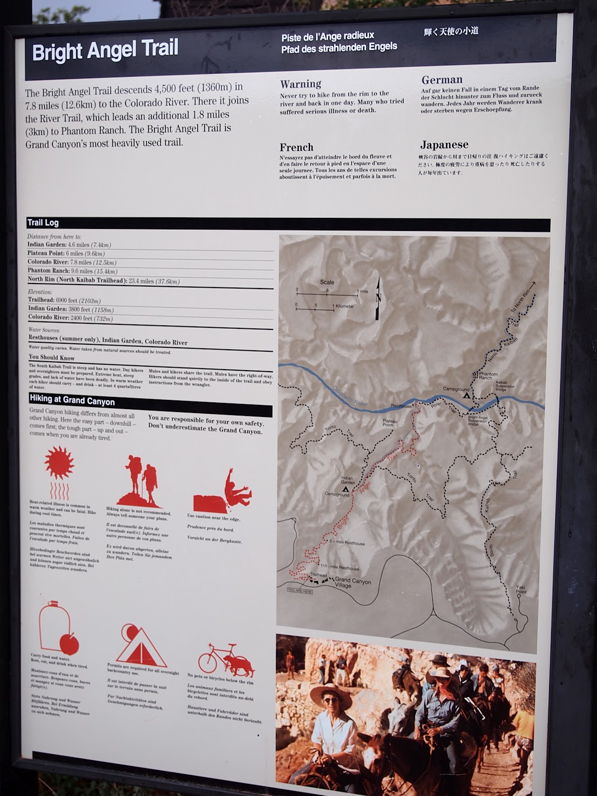
Actually, we were pretty sure we wouldn't die, but it was a 9 mile hike with about 1 mile of elevation gain.  Here's why it is recommended that you prepare:

Let's see...What does that say after  "STOP"?  Avoid uphill hiking between 10am-4pm May through September?  Total fail on that one.  OK, so reading the rest of it, we actually did exactly what they recommend for the rest of the warning sign.  Bear in mind that the sign seen here was at the south rim, not the bottom, so we really didn't know any of that until later.  Well, we actually did know we needed to be prepared thanks to John and also the Park Service website (we are librarians after all).


Back to the story.  So we set out at 6:30am and crossed the Silver Bridge:
And promptly encountered more of that pesky beautiful scenery.  I took a few more pictures on this leg simply because there was so much to gawk at, you just had to stop!  Once across the bridge, the trail runs along the Colorado River for a couple of miles.  During that time we passed through several types of terrain.
The mighty Colorado - its hard to get a feel for how gigantic it is.

Box canyon along the trail

Sand Dunes!


This is the stage where we learned that the worst type of terrain to hike through while carrying a full pack is...loose sand.  It was pretty though, and Donna got the beach vacation she had been wanting!  After the stretch along the sand you get to the landing area where rafting tours meet the Bright Angel.  I was finally able to get a picture that provided a little perspective as we rounded a bend approaching the landing.
8-man rafts

Like a cork


We arrived at the stop on the trail that marked the start of the ascent to the South Rim.
Preparing for the ascent

Hidden rest stop by the brook


From this point, there is nothing in the way of rest areas or water until you arrive at Indian Garden.  In between is a place called "the Devil's Corkscrew".  Nice.
And...she's off!

Off the frickin' "rugged" charts


So, apparently I didn't actually get any pictures of the Devil's Corkscrew and that's probably for the best.  Lends a little mystery, don't you think?

The scenery along this stretch went from one amazing scene to another.  As you approach Indian Garden, the familiar Grand Canyon views change to this...this...set from a sci-fi movie:
Wha???

The trail to the Garden


After a tour through what could only be described as a Hollywood set for a Clint Eastwood movie, you come to a place called Indian Garden.  Hallalujah!

Hooray!  Water and rest!

Thanks, Park Service!

Of course, our respite was not without trial.  If one thinks that the squirrels of Phantom Ranch are a challenge one has underestimated the cunning nature of the Kaibab squirrel...

Stay tuned for the exciting conclusion to this story in the upcoming cleverly titled episode, "Bright, bright Angel, pt. 2"

Tuesday, August 16, 2011

Life at the bottom...

Since MG and I ended our long march on a positive uptick, we spent the next day resting and letting our feet recuperate.  So, we spent the day soaking our feet in the lovely Bright Angel Creek and wandering around looking at all the natural beauty.  There is plenty of it - nevermind the squirrels - and you really can't help but practically fall over photo opportunities.

The perfect rock for a seat

Prickly pears with blooms
Random park bench view
Same bench
No polarizer
Ran out of color completely


So we also spent a good deal of time just walking about and taking pictures.  I had wanted a better camera than our little Canon, so I spent a good deal of time before the trip researching.  It had to have a mix of features, expandability and most importantly, lightness for this trip.  Besides Vasque hiking boots, I would offer a plug for Olympus cameras.  Here's the camera we took with us:
Ours is silver - couldn't find a pic of that one
It's an Olympus epl-2 and I have to say that I like it better than any camera I've ever owned.  Now, bear in mind that unlike MG, I've owned very few cameras, have never had a photography lesson, and really am not very good at taking anything other than snapshots.  I took a little more care here since we had the time and spent a little more time playing around with our new camera's settings.

Thursday, August 11, 2011

Tactical Retreat

The return hike back down to Phantom Ranch was fraught with uncertainty.  Was MG too fatigued to make another 7 mile hike?  Would there be campground space?  Was it possible that the afternoon heat would be too much for both of us?

So, we paced ourselves and hoped for the best.  Unfortunately, for the first 3 miles or so, the July sun beat down on us relentlessly and we made very poor time, stopping at every bit of shade and cursing the trail designers for not placing those upper 3 miles of path closer to Bright Angel Creek like it is (by necessity) in the box canyon portion.
Bright Angel Creek in the box canyon
Phantom Canyon on the North Kaibab


But we started to catch a series of good breaks as we entered "the box".  The good thing about hiking in July is that the monsoon season is underway - which means clouds.  As it clouded up, our spirits (and pace) picked up.  We started to think that maybe we'd make it back to Phantom before dark.

AND WE DID!

Ah!  A cabin - so near, yet so far!
So we stumbled back in to Phantom Ranch with 14 miles on our feet for the day.  So we walked staggered up to the canteen window (it was closed for dinner prep when we arrived) and the conversation went like this:

ME:  "We planned to hike to the north rim today, but could only make Cottonwood Campground.  The other part of our group had the back country pass so...what are our options."

WONDERFUL Xanterra person: "Well, do you want beds?"

We made it!, but what now?

ME:  <stunned into silence>  "Uh, sure!  You mean with like showers and AC?"

WXP:  "There were lots of cancellations for the dorms today - pouring rain on the south rim.  We should have dorm space for both of you."

ME:  "Heck yes!"

WXP:  "What about dinner?"

ME:  "TWO of them?"

WXP:  "Yes?"

So that evening, we had everything we'd hoped for if we'd climbed out of the canyon.  We had beds, dinner, AC, showers, and we weren't dead.